
Hagemeier, Anne (2024) COMBing Through Time. 3D Models & Digital Object-Based Learning.
This thesis aims to assess the importance of the use of digital object-based learning (OBL) for public outreach initiatives in archaeology, focusing on a case study involving an Iron Age comb. The goals were to create a virtual learning environment with interactive 3D models, integrate storytelling elements into the virtual learning environment, and a pilot study setup. This thesis is based on the theoretical framework of digital object-based learning and expands previous studies based on the use of interactive 3D applications for public outreach within archaeology. The questions this thesis addressed were:
In what manner(s) can 3D models be used to enhance engagement and understanding of archaeological artefacts among the general public compared to traditional static displays? In what way(s) do contextual storytelling elements enrich public outreach and educational value of interactive 3D models showcasing archaeological artefacts? What challenges and limitations are associated with implementing digital OBL approaches, for public outreach aimed at engaging audiences with archaeology?
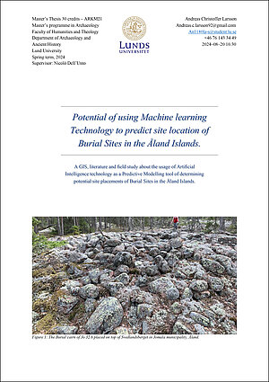
Larsson, Andreas (2024) Potential of using Machine learning Technology to predict site location of Burial Sites in the Åland Islands.
This study seek to explore the possibility of using a semi–automated deep learning approach to predict potential burial mounds and cairns in Åland, utilizing the latest high–resolution LiDAR dataset. Although only 4 of the 14 study areas were thoroughly surveyed, the AI/ML system was able to identify sites interpreted to be potential burial sites. As archaeological sites are provided legal under the Ålandic cultural heritage act called Landskapslagen (1965:9) om Fornminnen, it is important to find any potentially significant archaeological site to ensure its legal protection. Therefore, the study suggest that AI/ML systems have the potential to revolutionize the fields of archaeology and Cultural Heritage Management in Åland, with the hopes that similar studies can explore the possibility of finding forgotten archaeological sites in the archipelago region where little have been previously surveyed.
Mortensen, Daniel (2024) Visible connections of cult and continuity
This thesis is an attempt to evaluate the pre-Christian and Christian and cult-place continuity question. This is done by investigating intervisibility between Christian Churches and pre-Christian grave monuments within the province of Halland Sweden. This analysis was done via large statistical GIS databases of which viewshed analysis was applied to, which in turn was then interpreted via theoretical frameworks of materiality and landscape. Its conclusions are that visibility alone cannot be a determining factor for assessing cult-place continuity, as such, but that it could be an informant on spatial continuity within landscape over extensive periods of times. It was found that the main correlation between church locales and pre-Christian monuments are often the communication networks and the habitation zones which both accordingly shows evidence of extending far back in time. Though this might be useful for informing on spatial use, and cultural memory through monuments in landscape it’s not as likely to be helpful in informing on cult place continuity.

Kakoulidou, Georgia-Nikoletta (2024) Dissemination of Archaeological Knowledge through Digital Technologies: The Case of the Multisensory Museum
The present study aims to address this gap and initiate a dialogue about the importance of adopting a holistic approach concerning the integration of digital technologies in the archaeological museum. To accomplish this, two case studies—the Bryggens Museum in Bergen and the Viking Planet in Oslo—have been utilized. This thesis evaluates digital technologies in museums based on visitor engagement, factors that should be considered when integrating digital technologies in exhibitions, and potential challenges from the perspective of the museum professionals. By using the post-phenomenological framework and by conducting both exhibition analysis and interviews with museum experts, this paper addresses certain areas that have been understudied. The results show the benefits of digital turn employed within a museum setting and the challenges that might arise if such elements are only being used to draw visitors’ attention instead of fostering a symbiotic relationship between visitors, artifacts, and devices. Finally, after highlighting potential areas that need further research, this thesis concludes by claiming that the archaeological museum should be receptive to perpetual change, as is the case with the discipline of archaeology itself.
Skarphéðinsson, Indriði (2024) The Fjörður Midden, A Volumetric approach to a 10th to 11th century midden
This thesis explores a method of volumetric modelling through 3D Geographic Information system (GIS), as a part of post-excavation research in a rescue archaeology project. The process is based on data generated through the combination of photogrammetry and more traditional documentation methods. The subject of research is a 10th to11th century midden feature at the Fjörður site in East Iceland. The paper outlines the method used for volumetric modelling and explores how it can provide insight into human activity when looked at in context with other archaeological material found at the site. This is in part achieved by looking at the density of artifacts, slag and charcoal from the midden through the volume generated by the volumetric models. The datasets used in the process are reviewed and their impact discussed in terms of their strength and weaknesses. The addition of 3D technologies proved to be essential to the process and provided a stable base on which the volumetric representation could be built on. The paper also discusses the impact of both volumetric modelling and 3D documentation in the context of development-led rescue archaeology projects in Iceland, where the suitability of the methods is examined in relation to the archaeological material present at the site.

Weidkuhn, Delia (2024) Visualizing Territoriality. Studying the earliest Boundary Stones of Basel digitally and through a theoretical framework.
The master’s thesis re-examines six boundary stones from the late 15th and 16th centuries, raising new methodological and theoretical questions about the objects and considering the new conception of borders. The approach involves examining the stones through image-based 3D models, iconographic and iconological analysis, and a contextualised historical interpretation. The theoretical concept of territoriality will also be applied. It will be established that boundary stones fulfil a variety of functions and tasks. These stones are employed as tools of territoriality, with the aim of controlling relationships, people, or things within a geographical area. The utilisation of digital tools will illuminate hitherto unidentified aspects of boundary marking practice, suggesting that similar research would be beneficial for other boundary marking systems. Moreover, the identification of boundary markers as a tool of territoriality raises further implications that require further in-depth research in the future. The use of territoriality suggests that state-building processes were involved in the period under study. However, the extent to which this is true requires further investigation, particularly in the context of the Basel case study.
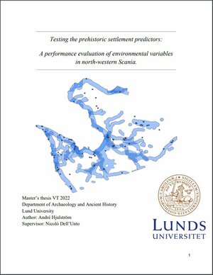
Hjulström, André (2022) Testing the prehistoric settlement predictors: A performance evaluation of environmental variables in north-western Scania
This paper goes over the process of evaluating the environmental variables, which are most likely to predict the locations of prehistoric settlements in a Scanian setting. This is accomplished by selecting variables which have shown to be successful in previous similar study areas and testing the spatial correlation between each variable and known settlement presence. This is followed by an overlay analysis in a GIS environment to test the overlapping areas between the variables. A theoretical background, which legitimise and problematise the methods used are included to put predictive modelling in context with archaeological scientific development. The results show that soil type, distance to major lakes and rivers and distance to coastline shows statistically significant positive correlations with settlement presence. This also holds true for the overlaid intersecting areas between said variables.
Bello Cifuentes, Gianni (2021) Taphonomic Markers and 3D-Modelling - A Non-Intrusive Method for Micromorphological Distinction of Metal and Stone Butchering Tools
Digital tools in (zoo)archaeology have great potential for education, mediation, and research. Microphotogrammetric 3D-modeling offers new non-intrusive analytical approaches to old problems and questions. This thesis aimed to perform morphological differentiation between cut marks made from lithic and metal tool using qualitative and statistical quantitative approaches (Principal Component Analysis). Osteoarchaeological material with cut marks from three Swedish sites were used: Huseby Klev (Mesolithic), Gamla Skogsby (Iron Age), and Falsterbo (Medieval). Modern material from lamb (Ovis aries) were subjected to experimental cutting (slicing action) using a steel knife, unretouched flint, uniface flint, and biface flint. All specimens were modelled using a digital camera with a macro lens, resulting models of the archaeological and modern material were compared to each other. Models of the modern material cut with flint tools were unusable for comparison, only steel cut marks yielded useful results. The archaeological material was qualitatively distinct from each other and from the steel knife cut marks. The PCA results demonstrates this distinction, displaying clear data clustering between the archaeological and modern specimens. The qualitative results also confirmed the archaeological cut marks to be the outcome of chopping action, not slicing action.
Johnstone, Filip (2021) Representing a Roman Portrait: An investigation of archaeological digitisation
This thesis aims to explore the uses for digitised information in the archaeological knowledge process, specifically on how it can be used when studying Roman portraits. By communicating the entire process from data acquisition and analysis to knowledge transmission and mediation, I hope to indicate strengths and weaknesses in the use of digital representations as a proxy for a physical artefact. The thesis also includes an intermedial analysis on how information has been transmitted in museum catalogues as a part of a reflexive approach to the information selection process. The dataset of selected and produced information will then be used to test different digital environments and lead to a discussion on different types of media’s suitability for knowledge transmission and digital literacy in archaeology. The result of this thesis is to illuminate the ways that digitisation of artefacts in material collections is similar or differentiates from other types of archaeological digitisation.
Hildenborg, Matilda (2021) Every picture in its place - A spatial analysis of rock art in Tjust using GIS
Rock art is the closest we have to a written language from the Bronze age. The different motifs make us wonder what stories they tell us, what they are representing and why they were even made in the first place. The focus of this thesis is on the placement of rock art motifs on the panel and by using digital techniques like photogrammetry and GIS, the spatial relation between different motifs is examined. Do certain motifs have a predetermined place on the panel, and how do the panel, cosmological beliefs, and people, who interacted with rock art then, affected the placement of motifs? To study this, ten rock art panels were chosen from Gamleby parish in Tjust in eastern Småland. Tjust is well-known for being a landscape filled with remnants from the Bronze age, and it constitutes the rock art richest area in Småland. Spatiality and digital technology were the theories and practices used for studying the placement of rock art motifs. By treating the panel as a topographical landscape and look at density, distance, slope and topography, it’s possible to study rock art in relation to the rock panel. What this study shows is that motifs are concentrated in certain parts of the panels, with small differentiations between individual motifs, and that the panels’ texture, including cracks and striations, could possibly have been affecting the way motifs were placed on the panels.
Bellis, Jason (2020) Overview of the State of Long-Term Preservation in terms of Reuse, Visualization, and Distribution of 3D Data in Archaeology
In archaeology, we face a unique situation where our primary research method is destructive; excavation as a recording method can only be conducted once. But with the introduction of modern 3D recording methods, much of the process of excavation can be saved and reused. But at the same time, we must overcome the difficulties of examining sites where the data recorded has been accumulated over vast amounts of time which uses a wide variety of technologies and data standards. These factors combined make reuse of historical excavation data difficult, and reuse of our digital records such as our 3D assets a difficult task. The digital age brings forth questions of future-proofing modern research and data for long term preservation, reuse, visualization, and distribution capabilities. This paper examined the practices and standards currently being utilized surrounding our 3D assets in archaeology and analyzed via a variety of case studies ranging from museums, digital repositories, and archaeological excavations. This investigation includes ethical and theoretical discussion on archaeological data management and long-term digital data procedures while discussing the question of the role of accountability of the modern archaeologist in this modern technological frontier in terms of reuse, visualization, and distribution of these 3D resources we now create.
Howorth, John Paul (2020) Archaeobotany in the 4th Dimension: Visualising Specialist Data in a 3D GIS
Archaeobotany and GIS are closely linked with archaeology, it is hard to imagine a modern archaeological investigation without them. The two appear to complement each other. GIS links highly complex sets of data with space, and offers a range of analytical tools. Archaeobotanists look for patterns in data over time and space to interpret human behaviour. Yet GIS is underused in archaeobotany. There is a gap between the capabilities of GIS and how it is used by archaeobotanists. With GIS moving into the next dimension, this gap will grow. The problem conceivably stems from the fact that results of archaeobotanical analyses are devoid of spatial data. This thesis develops a methodology in which archaeobotanical data are reunited with location within a 3D GIS. Using material from the 2016 and 2017 excavations at Uppåkra, a 3D GIS was built. It incorporates newly created 3D objects which contain archaeobotanical data. A case study was used to revisit an investigation into Iron Age beer brewing at Uppåkra. The use of 2D GIS in the original study was critically assessed. The new methodology was then used to visualise archaeobotanical data in 4D. Visualising the data in this way opens new perspectives, widens the scope of investigation and shifts focus from viewing single plant types to the whole assemblage. The thesis concludes with a theoretical discussion about how this methodology could affect future research, considerations to be taken into account and how it fits within a reflexive approach to archaeology.
Georgana, Panagiota (2019) Employing immersion to communicate archaeology: A visitor-centered approach
The present thesis examines how the museum visitor’s experience is being transformed by various developments and particularly by the advent of virtual reality technology. The research focused on identifying the problems of communicating the archaeological information to the museum audiences while highlighting best practices and proposing solutions. The immersive function of virtual reality was examined for its potentials to enhance the visitor’s perception, learning process and overall museum experience, while an attempt to restore how immersion is being perceived in the cultural field has been made. At the same time, common misuses and traps were highlighted and followed by instructions for the best employment of virtual reality by the museums. The User Experience (UX) Design approach is proposed by this thesis as a potential standard methodology to be adopted by the museums for interpreting the results of the visitor studies into concrete design solutions. Finally, all the insights gained during this research were accumulated into a framework of principles, aims and guidelines for the optimal museum experience with the incorporation of virtual reality.
Denninghaus, Fraya-Noëlle (2019) Arrangement of space inside Ölandic ringforts. A comparative study of the spatial division within the ringforts Eketorp, Sandby, and Ismantorp
In the Iron Age AD, ringforts were constructed on the Swedish island Öland. Most of them contained a settlement inside. The remains of 15 of these ringforts are still preserved in the landscape. This thesis gives a general overview of the known and the possible Ölandic ringforts and their historical and constructional context, before analysing and comparing the settlements inside the ringforts Eketorp, Sandby, and Ismantorp regarding their spatial division and arrangement. At that, the focus lays on the main settlement phases in the Iron Age. The analysis was conducted to explore if there is a pattern in the arrangement of the settlements inside the ringforts and further to investigate the importance of sufficient open areas. In doing so, the arrangement and grouping of houses and open areas, the relation of built-up and open space, as well as the development of the respective interior settlement are analysed. The ringforts were an isolated and small settlement complex. Thus, usually there were houses with different kinds of functions (e.g. dwellings, stables, storehouses, workshops) within the ringforts. The results of this study show that there was more built-up space than open space inside each of the analysed ringforts. It is to assume that the open areas were used as public space respectively settlement squares. Consequently, it seems that the priority was to fit as many houses as possible into the limited inner area. Nevertheless, it was also important to have sufficient open areas (in terms of streets and squares) according to the ringfort’s function(s) and needs, as well as a well-connected street network inside the ringforts. The amount of open space probably depended on the ringfort’s function(s). Furthermore, the analysed ringforts were arranged similarly, with houses placed radially along the ring-wall, creating a large open place in the forts’ centre that was built-up in a later phase. A suggestion is that the ringforts all had a first phase in which houses were built only along the ring-wall and the centre was left open for a certain time – maybe until about 400 AD. This theory, however, is speculative and there is no proof for it yet; for that more excavations are needed.
Cavka, Matea (2018) Once upon a time in Germania Magna. The relation between terra sigillata and the historical events in the northwestern and northeastern Europe (1-400 CE)
During the period of the Roman Imperial Period the area north of the Roman limes, Germania Magna, was influenced from the Roman Empire. The varied interactions between the Romans and the Germanic population, living beyond the northern frontier, has broadly been studied during centuries. One of these aspects have been to further understand the relation and the Roman- Germanic interaction by investigating if the military and diplomatic campaigns of the Roman Empire have affected the influx of these goods as well as the Germanic population. Countless of different vessels have been studied and has been believed to have been traveling together. However, later studies have shown that there seems to have been a difference in the material of the Roman pottery terra sigillata. It seems that this pottery type has followed another distribution pattern in comparison to the other vessels. Although the distribution pattern has shown to be different in comparison to the military and diplomatic campaigns, not much focus has been given to the impact of this on the distribution of terra sigillata. Therefore, this thesis is to further relate episodes of military and diplomatic campaigns of the Roman Empire to the distribution of terra sigillata north of the Roman limes. With the use of distribution maps made in a Geographical Information System as well as compilations of Roman finds it has been possible to analyze the material. Furthermore, the narrow dating of terra sigillata has further made it easier to discuss this. It has been proven that the distribution of terra sigillata has been following the military and diplomatic campaigns of the Roman Empire. However, this has not been the only reason for the distribution. An increase of terra sigillata in Germania Magna in the period around 150 CE to 200 CE suggests that the distribution was not longer only following the military development beyond the frontier. A suggestion is that there was an increase in the market as more consumers were introduced. It is possible that the export of terra sigillata was no longer in the need for military and diplomatic campaigns to travel. Furthermore, a contextual difference between the northwestern and the northeastern distribution shows that terra sigillata in the northeast have had a determined value as the majority of these have been found in burial contexts. The different changes in the production and the military and diplomatic campaigns of the Roman Empire seems to not have had any affect on the contextual difference in the northeast. However, the area beyond the frontier along the Danube, which was closer to the Roman presence in the northeast could further indicate if this correlate to the northern distribution.
Nagy, Edmond (2017) The limes of Roman Dacia near the auxiliary fort of Bologa. An application of GIS viewshed analysis
This thesis examines the frontier defensive system found in the vicinity of the Roman auxiliary fort near modern-day Bologa, Cluj County, Romania. The goal is to study the visual relationship between the more certain watchtowers and the other military installations (the auxiliary fort and other fortlets) to understand how arrangements and visibility might have contributed to the functioning of the local and the provincial defensive system. Although the study focuses only on a smaller section of the Roman frontier, and covers a more limited timeframe (second to third century), the results obtained might be relevant to other parts of the Roman Empire, where characteristics similar to this section had been found. Frontier defences were important for preserving peace and stability within the borders of the Empire, and studying them would help researchers understand how that was achieved at different times in different places. In the first part of my thesis, a general overview of Roman military installations and frontiers is provided. Next, the research history of the sites examined in this study is presented, followed by a more detailed discussion about the aims, sources and methodology. After that, the type of analysis performed in this thesis is explained, followed by a step by step documentation of the entire process. Towards the end, the results are presented, discussed and interpreted in relation to previous research on these archaeological sites, but also in relation to those found in other relevant locations, as well as Roman provincial and imperial defenses in general. The conclusion is that this section of the limes seems to display characteristics typical for a defensive system.
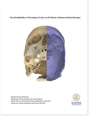
Placiente Robedizo, Bebelyn (2016) The Identifiability of Osteological Traits on 3D Models of Human Skeletal Remains
Previous studies have entertained the prospect of having 3D models substitute for their dry bone originals in osteological analysis. The objective of this study was to contribute to qualifying to what extent this may be possible given current technology. To this purpose, rather than choosing just a quantitative and purely technical method for evaluating models, as has been the norm in previous studies, a qualitative method was also applied where the visual identifiability of the traits was taken as the standard. A cranium and a metatarsal bone were chosen as case studies, and three types of models were created of each specimen – a scan-based model, an image-based model and a model combining geometry from scans with textures from photos. The relative identifiability of the traits on the different models was graded and compared, and the factors that contributed to the results discussed. The study found that while 3D models may hold some advantages over photo documentation as substitutes to originals in osteological analysis, primarily due to preserving much of the originals’ geometry, the technology also suffers some disadvantages, notably that the textures’ image quality often fall short of photos, especially when superimposed on distorted geometry generated from scans. It can also prove difficult to create models capable of representing all parts of their originals equally well without making the models excessively heavy. Furthermore, the study showed that some morphological traits were more difficult to digitize and thus less identifiable on 3D models than others, and that qualitatively evaluating 3D models is a complex and challenging task. These results challenge assertions about the capabilities of 3D models in previous studies, and suggests that establishing a common standard for evaluating digital models, such as the identifiability of osteological traits introduced here, is a desirable development in digital osteology.
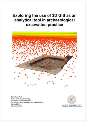
Van Riel, Sjoerd (2016) Exploring the use of 3D GIS as an analytical tool in archaeological excavation practice
Several digital technologies are now available to record and document archaeological excavations. A large number of studies have been published concerning the use of laser scanning, image based 3D modelling and GIS. By integrating different typologies of 3D data from Uppåkra, an Iron Age central place in southern Sweden, this thesis focuses on the development and evaluation of how 3D Geographic Information Systems (3D GIS) affect archaeological practice. In specific a Digital Terrain Model (DTM) was created for the site and the surrounding landscape. A UAV (drone) was used to document the excavation area in higher resolution, and image based 3D modelling was used to record the ongoing excavation on a single-context level. These different typologies of data were subsequently imported in a 3D GIS system (ArcScene) in order to conduct various types of spatial analysis (e.g. hillshade and slope analysis) as well as to create 3D drawings of the excavated contexts, using the textured 3D models as a geometrical reference. The ability to virtually revisit previous stages of the excavation and the use of tablet PC’s for documentation and discussion at the trowel’s edge increased reflexivity on the excavation and stimulated on-site interpretation by the excavation team. The model based drawing approach furthermore improved the drawing resolution compared to traditional documentation using a total station, especially for complicated contexts. This approach allowed connecting different typologies of data in the same virtual space, 1) increasing the possibility of researchers and scholars to gain a complete overview of all the information available, as well as 2) exponentially increasing the possibilities to perform new analysis. The ability to interact and navigate with all the data in 3D improved the impact of the data and comes closer to simulating the real world. Though some challenges still have to be faced, such as inaccurate georeferencing and unrealistic colour projection, the method was found to significantly improve the documentation quality by creating a multi-scale 3D documentation platform. By further developing this method, it can help us to improve the standards of archaeological excavation documentation.
Siljedahl, Carl-Olof (2015) Monuments in the Landscape: A spatial analysis of rune stones in Västergötland during the Late Viking Age and early Medieval period
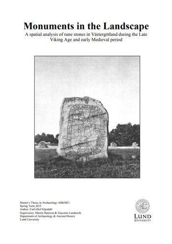
There are several aspects of rune stones that can be discussed and analysed. With the help of digital tools, it is possible to look at social dimensions of archaeological objects in ways that were previously difficult to explore. In this thesis, the aim is to analyse rune stones from a spatial perspective by looking at their possible role in the landscape, what type of context they are found in and what they manifested by using both traditional and new methods/tools. The main focus is placed on the central region of Västergötland, a region that has not received much attention concerning findings and sites from the Viking Age. This is the first time such an analysis is conducted on rune stones in the region. Spatial analysis of the landscape is a fruitful way to study how people interacted with each other and how certain people choose manifest themselves and their role in the local society. Rune stones contain a great amount of information depending on how they are analysed. This is an attempt to create new ways of
analyzing rune stones and expand our knowledge about the Viking Age and early Medieval period in Västergötland.
Read more...
Björk Hillberg, Niklas (2015) Digitizing Material Culture
Archaeology has always centred on material studies and has a long tradition of establishing methods for addressing the vast source material at hand. Typology is one of the most prominent of these methods, where the material is categorised into types according to morphology and geometry. There is an ongoing debate regarding the subjectivity of the typological approach and the problems that follow this issue. In recent years, there has also been an increase in the use of digital methods in archaeology to tackle many of the problems present in previous archaeological work, but this has mostly focused on field and buildings archaeology. This thesis therefore aimed at testing and discussing the application of digital methods of documentation and analysis within the field of material studies. It was investigated how a digital approach could aid and solve some of the current issues of the field of study, but also how it can further improve the science. This was done by establishing a digital work-flow, conducting analyses and discussing the theoretical and methodological
aspects of the digital approach. It was concluded that there are several advantages to be gained from using the digital method, especially in detail-oriented studies and surface analyses, and that it can also be employed to greatly improve the typological method in regards to the debate of subjectivity, but that the method must be used in a proper way for this to be achieved. It can also aid in the spread of knowledge and documentation within the archaeological discipline, as well as providing the tools for deeper analysis and understanding into the material culture
Friberg, Rasmus (2015) Observering Digitally - The use of Image-Based 3D Modelling Techniques for the documentation and study of Rune Stones
This thesis aims to test and evaluate the use of image-based 3D modelling techniques on rune stones. To test the method a well-documented rune stone was chosen, Hyby stone 1. The stone has been dated to the Viking Age and contains 37 runes, whereof 29 are still visible, two crosses and a stag. These carvings have been detected by other scholars with the use of non-digital methods. In order to evaluate the efficiency of this method it was compared with Danmarks Runeindskrifter from 1941-42, which is the standard source for Danish rune stones. The authors used electric light and cameras to document the stone. The thesis combines the commercial software Agisoft Photoscan and the open source software Meshlab. The former was used to create the model with Structure from Motion (SfM) and multi-view reconstruction and the latter for analysing the geometry by applying different types of shaders and then draw the visible carvings. The chosen shaders were two kinds of radiance scaling called lambertian radiance scaling and grey descriptor. By using this method it was possible to reach almost the same result as Danmarks Runeindskrifter. The method has proved its efficiency and allows for the definition of a workflow which provides a low cost efficient addition for the means of studying rune stones.
Moulin, Cléa (2014) Maquetas and ceremonial structures of the Mochicas, Jequetepeque Valley, Peru. A comparative analysis based on image-based 3D modeling
This thesis aims to use an approach based upon image-based 3D modeling in a comparative analysis of maquetas and ceremonial structures from the Late Moche Period in the Jequetepeque Valley, Peru, and determine if this approach is constructive in such an analyses.
During this work, one particular case will be used, comparing one maqueta from San José de Moro to one ceremonial structure of San Ildefonso (Jequetepeque Valley, Peru). This case study will allow me to determine if image-based 3D modeling is a constructive method in a comparative analysis and to interpret the significance of the maquetas.
Jacobsson, Oscar (2014) The River Flows Forever On: Landscape Agency in South-western Sweden, 550-1750 A.D
This thesis studies the interaction between rivers and human culture through a wide theoretical perspective combining the theories of Fernand Braudel, Jean-Paul Sartre, Homi Bhabha and recent “symmetrical archaeology”. While landscape archaeology previously to a large degree has been focused on phenomenology and studies of symbolic landscapes, this thesis tries to emphasise the importance of the land itself. Rivers have strangely been rather overlooked in landscape archaeology considering their central role in the natural landscape. Two river systems – Göta Älv and Ätran – are selected for closer analysis of the period between 550-1750 A.D. The main questions raised are:
- Have the rivers in question contributed to the construction of society?
- Has the interaction between nature and culture created riverine hybrid landscapes?
These questions are explored and analysed through the development of a geodatabase with digital information from several official databases such as: FMIS, SGU, SMHI, KARL, GEORG, Lantmäteriet and SDHK. The methodology is centered on the investigation of a large diversity of river uses, including the natural preconditions, economic factors and ideological aspects. Three case studies for each river are selected for a more detailed study and the synthesis is then analysed through a comparative perspective. The analysis shows that although there might be certain differences between Göta Älv and Ätran, some common patterns of character exist. Both rivers have clearly contributed to society in a large variety of ways and on a diverse number of levels. Both economically and ideologically Göta Älv and Ätran have affected their surrounding settlements. The hybrid character of the riverine landscapes is difficult to capture physically, although a few clear examples exist. Both milling and water meadows are suggested as examples of important factors in the creation of hybrid landscapes. Further suggestions for future research are also given, along with a discussion concerning the problematic nature of the present landscape archaeological discourse.
Perlinska, Marta (2014) Palette of possibilities: developing digital tools for displaying the uncertainty in the virtual archaeological “reconstruction” of the house V 1,7 (Casa del Torello di Bronzo) in Pompeii
This thesis has two major purposes: (1) to create a 3D virtual “reconstructive” model of the peristyle with the nymphaeum wall (room b) of the house V 1,7 (House of the Bronze Bull) in Pompeii, and (2) to prepare a probability map based on this model that will show the reliability level for each individual part. The author underlines the importance of recording paradata of the entire workflow. The aim of this study is to highlight the problems concerned with 3D virtual archaeological reconstructions – in particular, the lack of proper referencing tools and lack of reflexivity when presenting those models to the public. The basic data for this study were scans obtained in a framework of the Swedish Pompeii Project. One set of scans was imported into 3DStudio Max and the reconstruction was modelled with reference to it. After this stage, a probability map was created in order to present the plausibility of every element in the form of a color scale (green being most plausible, red being least plausible). Furthermore, the probability map was geo-referenced and visualized within ArcGIS. Once this task was realized, a database was created and linked in order to connect the different parts of the probability map with the sources used to perform the reconstruction. The project proved that 3D virtual models are useful tools in examining the spatial relations of the objects and the visual representation of the scene. The results obtained show the necessity of documenting the entire scientific process thoroughly. Furthermore, it was concluded that this subject needs to be more discussed by archaeologists, and that the scientific vocabulary concerning these implementations should be standardized.
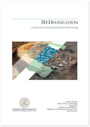
Kimball, Justin (2014) 3D Delineation: A modernisation of drawing methodology for field archaeology
A recent trend concerning archaeological research has focused on producing a real-time methodology for 3D digital models as archaeological documentation within the excavation setting. While such methodologies have now firmly been established, what remains is to explore how 3D models can be integrated more fully alongside other forms of archaeological documentation. This thesis explored one avenue by developing a method that combines the interpretative power of traditional archaeological drawings and the realistic visualisation capacity of 3D digital models. An experiment was developed during archaeological excavations at Uppåkra, Sweden where photographic data was captured to produce 3D digital models through Photoscan. These models were geospatially located within ESRI’s 3D GIS ArcScene where shapefile editing tools were used to draw overtop of their surfaces in three-dimensions. All drawings followed closely the single context method of drawing, were allotted context numbers, and given descriptive geodatabase attributes. This methodology resulted in the further integration of 3D models alongside other forms of archaeological documentation. The drawings increased the communicative powers of archaeological interpretation by enabling the information to be disseminated in a 3D environment alongside other formats of data that would have otherwise been disconnected in 2D space. Finally, the database attributes permitted the drawings complete integration within the geodatabase, thereby making them available for query and other analytical procedures. Archaeological information is three-dimensional, therefore archaeologists must begin to approach documentation bearing this in mind. This technique has demonstrated that 3D models are a fluidic form of documentation allowing for accurate preservation of archaeology while enabling new forms of data to be derived all within a limited amount of time. Archaeologists must begin to affect change towards embracing 3D models and their associated applications as a standard tool within the excavator’s toolbox.
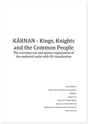
Holmqvist, Sara (2014) KÄRNAN - Kings, Knights and the Common People - The everyday use and spatial organization of the medieval castle with 3D visualization
This master thesis is about Kärnan, which is a medieval tower that is situated in Helsingborg. Kärnan was built during the beginning of the 14th century and was part of Helsingborg’s castle that belonged to the Danish king. This thesis investigates how the tower was used and which people were living and running the castle and how the castle affected the surrounding landscape. Fief holder were running and living in the castles while the Danish court traveled around and stayed at different castles. The medieval appearance of the interior is also discussed, and digital methods are used to test how the space have been furnished and used during the 14th century. An acquisition was performed with 3D laser scanner and image based 3D modeling was used, in order to create a digital replica of the building to use as a reference. The digital replica was merged with virtual furniture which was reconstructed using software computer-based visualization.

Roe, Freya (2014) Modernizing Millennia: 3D Models as Ethical Progress in Museum Practice
Practical knowledge of how to use digital technologies for archaeological purposes are rapidly becoming an in-demand skill set. Why we should use these technologies, however, is a subject of somewhat less discussion. Within the past decade cultural heritage management has seen a surge in tools that promise cheaper, faster and more precise data acquisition, as well as a host of software to enable easy and integrated access to this data. With increasing user expectations, what does this mean for museums which endeavor to integrate 3D modeling into their practice? This thesis will explore the chaîne-opératoire which museums progress through to adopt 3D models into their collections. Mission statements and points of ethical museum practice will be considered for each step in the process of implementing 3D model use, such as the motivations for inception, to funding, scale of implementation, maintenance, and results in the form of community support and access. The end-product is not the only valuable part of this process, nor is it the only one that can aid museums in engaging their community. By examining the ways in which 3D modeling impacts museum ethics and practice, perhaps a more enlightened justification than the technological superiority of new digital methods can be made for embracing it.
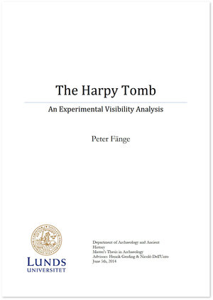
Fange, Peter LU (2014) The Harpy Tomb: An Experimental Visibility Analysis
A study done on the Harpy Tomb at Xanthus in ancient Lycia. This study is an experimental visibility analysis, the purpose of which is to explore to what extent the geometry of the bas-relief panels would be visible. Aspects which are taken into consideration for this purpose include distance and varying positions, as well as time of day.
Using modern laser scanning technology and 3D processing software, the plaster cast copies of the original marble panels were digitally recorded and their geometry preserved as a digital record. These were then implemented into a virtual reconstruction of the Harpy Tomb and its immediate urban surroundings which was then used to conduct the experimental visibility analysis. The results of these analyses give some idea of how the monument may have been viewed. The results also encourage further research on this subject
Karlsson, Christina (2013) Visualizing Archaeology - with Virtual Reality tools
This thesis is concerning how archaeologists can use virtual reality for the 3D visualization of archaeological data. By studying different case studies concerning virtual reality and archaeology, I will try to define how the use of this technology is employed today to transfer knowledge in the sector of Cultural Heritage.
During this work I will develop a virtual reality system about Bishops cellar (Biskopskällaren), an archaeological site located in Scania, Sweden. This work will allow me to design and analyze a workflow data construction for the creation of visualization system, the results of this work will be analyzed and discussed.
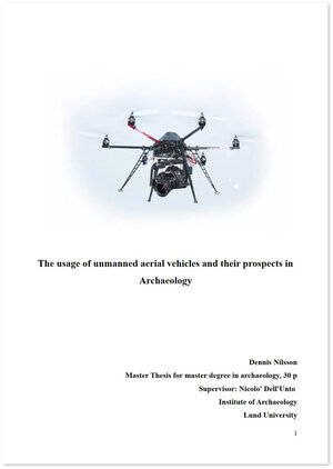
Nilsson, Dennis (2013) The usage of unmanned aerial vehicles and their prospects in Archaeology
Unmanned aerial vehicles (UAVs) are a recent addition to the archaeologist's arsenal of tools. They are capable of traveling in the air and reaching places that a human cannot. They are however not used in many places over the world.
This thesis' purpose is to illuminate the positive and negative aspects of how UAVs can be used in archaeology, in order to generate interest in the utilization. Their ability to acquire images that encompasses large and small areas is its main and most frequently used attribute. By using two case studies, the attributes of UAV's are put forward. The conclusiveness of data procured by UAVs and how it is possible to use this information in further studies are shown in these case studies. We see that the UAVs differ in abilities, and the result is often dependent of the quality of the available tools and gear.
Nesi, Linda (2013) The use of 3D laser scanning technology in buildings archaeology: the case of Måketorpsboden in Kulturen museum, Lund
This thesis is a project developed with Kulturen Museum in Lund for the documentation of a wooden building from the end of the 18th century. The technology applied is 3D laser scanning. The project wanted to answer several theoretical questions through the study and to conduct a practical case analysis, which lead to the production of a 3D textured model of part of the building. The work has been developed discussing in the beginning the state of the art of building archaeology, describing the different stages of study of buildings through history, from Renaissance to the seventeenth century and with an overlook of the approach of this discipline in the Nordic countries. Subsequently it has analysed the different kind of surveys for a proper archaeological building investigation: the direct survey and the indirect survey, explaining the differences and the technological innovation applied to this field especially during the last 20 years. A detailed paragraph about method of building investigation with the most recent laser scanning technologies illustrates the “pros and cons” of the utilization of 3D laser scanning for archaeological purposes; specific case studies are described. A final comment about the rising problem of handling and storing of data coming from the utilization of those new technologies has been taken in consideration. The last part of the paper is focused on the explanation of the background history of the typology of wooden building I have been studying and the detailed explanation of all the steps done for the actual project, from the acquisition campaign to the post processing of the data. An analysis of the data I got from the creation of the model of a single room has been performed with the examination of the possibility of future developments of the same project.
Graham, Chelsea (2012) Applications of digitization to museum collections management, research and accessibility
Over the past few decades, digital methods of documentation and exhibition have been becoming ever more popular in museums. As technologies advance, so too do the implications for museum digitization. This thesis provides a glimpse into the current atmosphere of museum digitization, proposes new applications for digital documentation and propagates these themes through the development of a case study. Applications of digital documentation and visualization to collections management, scientific research and dissemination are investigated. Among the foremost objectives of this thesis is to convey the manners in which digitization can give further value to museum specimens and unlock their potential to answer scientific and social questions. Within this thesis, the capacity for 3D models to make data more accessible, extend research methods and forge new relationships between researcher and subject are highlighted. Applications in museum collections management are also explored, especially how these methods aid collections staff in monitoring and conserving specimens for future study and diffusion. In terms of dissemination, issues of ‘universal collections’, virtual exhibits and digital repatriation are addressed. The propensity for digital visualizations to convey intangible aspects of cultural heritage and embody personal memories and experiences are duly probed. The work culminates in a case study, which follows the digital acquisition and creation of a 3D model of a classical Roman portrait from the collections of the Ny Carlsberg Glyptotek in Copenhagen. Both a technical and theoretical work, the case study underscores the potential uses of 3D models as canvases upon which to gather, project and juxtapose different kinds of scientific data. The case study is specifically developed to emphasize and create discourse concerning how 3D models can supplement or surpass current polychromy study techniques.
Ask, Carolina (2012) Interpreting in 3D - Employing 3D modeling in field archaeology from research and public communication perspectives
This thesis investigates the use of digital technology on the border between science and public communication. The author argues for a public archaeology that goes beyond an arranged communication, where only one final truth about the past is presented. Instead arguments are presented for the benefit of letting also non-archaeologists take part of the many ambiguities of archaeological excavations, thus experiencing the process in which knowledge about the past is created. The potentials in using 3D modeling as a way that involve the public in the interpretation process, and at the same time provide researchers with a deeper understanding of the archaeological context is investigated and discussed in this thesis. An experiment of 3D visualization of an archaeological excavation is developed where 3D models representing the excavation area obtained through Computer Vision techniques are combined with modeled 3D geometry representing archaeological interpretations made during and after the excavation. The layout of the models of combined 3D data describes the relation between archaeological features and interpretations of what they represent, which in a communication situation gives the public the chance to follow the reasoning of the archaeologists. From a research perspective, integrating the element of hypothesis visualization in the fieldwork process, provides a deeper understanding of an archaeological context, beneficial for the continuing excavation process. The case study was conducted using a systemized way of accounting for sources and paradata, being the record of the subjective discussions, decisions and choices made that leading to the visualization, thus emphasizing the importance of transparency in virtual heritage.